The sinking of Mexico City
The Valley of Mexico is subsiding at a rate of up to 30cm a year, a phenomenon exacerbated by the excessive extraction of groundwater, heightening the risk of flooding
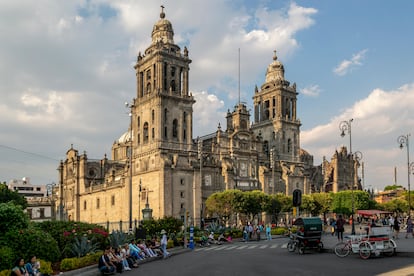

Mexico City’s record-breaking rainy season has exposed the capital’s vulnerability to flooding. Images of avenues as rivers, submerged cars and collapsed public transport have reignited the debate over the factors that put a megalopolis of more than 20 million inhabitants in check every time the rains reach their summer climax. Added to the impact of climate change, the city’s poor drainage system, excessive population growth and rapid subsidence all play a decisive role in heightening the risk.
“Mexico City is the most extreme reported case of subsidence in the world,” explains Darío Solano Rojas, a scientist at the UNAM’s Faculty of Engineering. Solano has dedicated the last decade to studying the subsidence of the capital, a phenomenon caused by the overextraction of groundwater and aggravated by the movement of the lake soil on which the city was built. Solano points out that this is not a new problem: the city has dealt with severe flooding since before the European conquest. “Since they built the pyramids with wooden piles, they put logs underneath them because they knew that the ground was prone to sinking,” he says.
The case of Mexico City is unique due to two factors: the natural environment of the Valley of Mexico, which consists of a system of lakes with soft sediments; and the extraction of groundwater to meet the growing demands from a burgeoning population. An expert in assessing the situation from satellite images, Solano says, “Let’s forget the city for a moment and evaluate this as a natural environment: we have a lot of mountains around us and the water is trapped; it is a basin. If we could walk on any lakebed, we would see that it is like a pot. The city’s terrain has a natural propensity for water to accumulate in the center, and from there it begins to fill up towards the shores,” he explains.
From east to center: How Mexico City is sinking
The speed at which the capital’s foundation is sinking is not uniform. Mexico City’s Atlas of Risks divides the subsidence of the capital into three categories: yellow, where subsidence is slower and advances from zero to 10cm a year; orange, where the subsidence is greater and reaches 11 to 20cm a year; and red, where subsidence is more severe and reaches 21 to 30cm a year.
Mapping these areas reveals a pattern of subsidence that increases from the center and reaches its most critical point toward the east, while decreasing to the west.
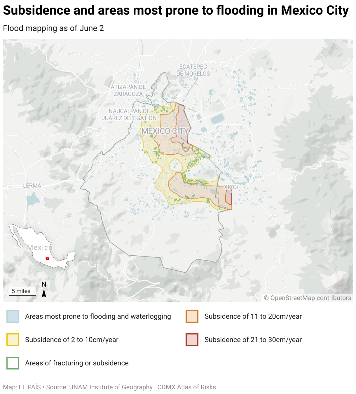
According to Emmanuel Zúñiga, a researcher at the UNAM’s Institute of Geography and an expert in flood risk, it is no coincidence that the center-east area of the city that presents the highest level of subsidence is also the region most affected by floods: “The center-east area is where we find the greatest flood-related disasters,” he tells EL PAÍS. “We have registered up to 50cm and more. It’s where the ancient lakes used to be and where the city is sinking the most. It is an area of natural water accumulation.”
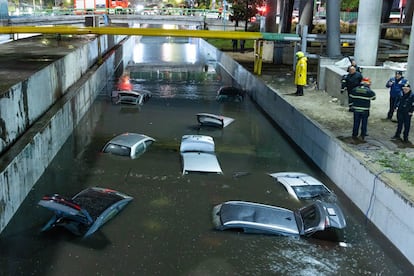
Zúñiga is part of a team that uses a repository of open satellite data to locate the streets and neighborhoods most affected by floods following each storm. After June 2 — the first major rains of the season that left an estimated 143 locations flooded and 64 cars affected — Zúñiga and the rest of his team published a map detailing the worst-affected areas. Social media buzzed with an image of cars completely submerged under a low bridge located between Viaducto and Circuito Interior, a point that connects two of the capital’s busiest highways in the east.
The June 2 storm was followed by a July of record rainfall: the 298 millimeters of precipitation that fell on Mexico City doubled the historical average for the month, calculated at 150 millimeters of rain. The June scenario was repeated on August 11, when the heaviest rain of the year caused serious damage, with special emphasis on the central-eastern area: the Mexico City International Airport — marked as a red area by the Atlas of Risks — suspended its operations as it dealt with flooded runways and infrastructure. In the historic center of the capital, the Zócalo and the surrounding streets also suffered serious flooding. “In Mexico City, the center of the basin is near the airport. It is logical to think that this is where it usually floods first,” explains Solano. In the municipality of Nezahualcóyotl, a dormitory town in the eastern Valley of Mexico, the drainage system collapsed, and water began to seep into the houses from the drains.
While Zúñiga and his team work with satellite data in search of patterns that can be used by the local government to make decisions in terms of prevention, Solano calls for a rethinking of civil protection: “Our response is designed for situations that are not so extreme. But climate change is demanding a global readjustment. We have to adapt to the new conditions because the trend is that these extremes, of precipitation and droughts, are going to increase,” he says. “Climate change is throwing up conditions the city has not planned for.”
Sign up for our weekly newsletter to get more English-language news coverage from EL PAÍS USA Edition


