What is fog and how is it formed?
The phenomenon is visible condensation, small water droplets that are suspended in the atmosphere

Fog has a huge impact on visibility and consequently on various human activity, particularly traffic, whether air or road. Basically, the phenomenon is visible condensation, small water droplets that are suspended in the atmosphere and reduce horizontal visibility to just over half a mile. When we talk about a reduction in visibility of between 1.8 and 3 miles, we are talking about mist rather than fog, which is made up of slightly smaller and less dense particles.
Fog appears as a cloud of varying density. It is similar to a cloud in its composition, but different in both how and where it forms. Clouds are formed when the air rises and cools and fog is formed either as a result of cooling or by an increase in water vapor until saturation is reached, producing condensation.
Fog varies, depending on its formation. If it is formed by an increase in vapor, it is known as evaporation fog, which includes vapor fogs and frontal fogs. These usually form over seas, lakes and rivers. When cold air moves over comparatively warm water, surface water evaporation can occur. This water vapor rises to mix with the cold air, becoming saturated and producing condensation. It is really a mixture of two types of air mass with different water vapor content that generates the fogs typically seen over the sea or lakes.
Frontal fogs, on the other hand, occur when either cold fronts or warm fronts are present. The warm air rises above the cold air, producing rain. The rain that falls on the cold air has a temperature very close to what in meteorology we call dew point, which is the temperature at which saturation occurs. It is also the point at which this fog is produced. This type of fog is usually very thick and hangs around.
However, if the fog is formed by cooling, radiation, advection or orographic fogs can be produced. Of these, radiation fogs are the most common. I am from Seville in southern Spain and we get these a lot in winter. They often affect road and air traffic. This type of fog occurs when we have cloudless and windless nights. The Earth’s surface loses heat by radiation, the air adjacent to the surface cools and, as there is no breeze to generate turbulence, it forms a layer of fog that remains stuck to the surface. When there is more wind, the layer will rise by about 20-30 meters. Radiation fog usually disappears one to three hours after sunrise.
Sometimes when moist, warm air is blown by the wind onto a cold surface, it is cooled on contact and, if there is sufficient moisture, what is known as advection fog is produced. A wind of at least 24-32 miles/h is required to facilitate both horizontal movement and vertical air mixing. This happens, for example, in coastal areas and also in summer.
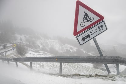
Finally, there is what is known as upslope fog. This is fog that forms over mountains. The air that rises on a mountainside cools down to dew point temperature so that fog or clouds can form.


