Spain issues new weather alerts over heavy and persistent rains in Balearics and Mediterranean coast
The State Meteorological Agency expects abundant, very strong and persistent rainfall from Tuesday, just two weeks after the worst DANA to have hit the country so far this century
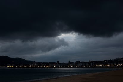

A new adverse weather front is threatening Spain this week as a result of the arrival of a cold storm from northern Europe, according to Rubén del Campo, spokesman for the State Meteorological Agency (Aemet), who issued an initial information note on Sunday to warn the population and the authorities of what is coming. Aemet expects abundant, very strong and persistent rainfall in the Balearic Islands and on the Mediterranean coasts from Tuesday, just two weeks after the worst so-called gota fría, or DANA — an autumn weather event typical of eastern Spain — to have hit the country so far this century. In addition, this storm front will bring sudden winter cold, as it will be accompanied by a swift and widespread drop in temperatures, with snowfall at an altitude of 800 to 1,000 meters in the north of the country.
In its warning, Aemet describes the sequence of the new storm: a mass of cold air is moving from northern Europe to the southwest and will be isolated from the general circulation, that is, forming a DANA, which will reach the peninsula and the Balearic Islands on Tuesday. This weather front will worsen on Wednesday in the Mediterranean and will remain in the vicinity of Spain at least until Saturday. The increase in instability “will be accompanied by the entry of a humid Mediterranean flow from the east,” Aemet said, that is, providing more fuel for the rainfall.
“The uncertainty about its final position is high and this determines both the distribution and the amount of precipitation,” warns Del Campo, who urges the population to be attentive to the updated weather forecast and warnings. Another important aspect is that temperatures will drop significantly between Tuesday and Wednesday. The big question now is whether this storm will be as destructive as the previous one that affected mainly the Valencia region, causing over 200 fatalities and widespread destruction of homes and infrastructure. “This situation presents even greater uncertainty and, although in principle it does not seem that it will rain as much, it will do so in an already damaged area; the south of Catalonia, Castellón, and southern Valencia, so the vulnerability is higher,” Del Campo told EL PAÍS. The expert added that 60 to 80 liters of water are expected in those areas between Thursday and Saturday.
The forecast, day by day
On Monday, the day before the new storm is expected to arrive, strong winds are expected in the Empordà region of Catalonia and the Balearic Islands, and there are likely to be localized heavy showers in the Pityusic Islands (which include Ibiza and Formentera) and potentially in Alicante. There is a yellow warning in place — the minimum — for rain and rough seas in the Balearic Islands and for rough seas in Catalonia.
On Tuesday, the cold storm will approach Spain and instability will increase. “There will be rain in a good part of the northern third of the peninsula, which will be abundant in the eastern Cantabrian Sea,” Aemet said. There are also forecasts of “stormy showers, which could be very strong, on the Mediterranean coasts of the Levant and in the Balearic archipelago.” How much rain are we talking about? “Especially in the Balearic Islands, 30 or 40 liters per square metre could accumulate in just one hour, and this could lead to some flooding in low-lying areas,” warns Del Campo.

The precipitation will come in the form of snow in the mountains of the northern half of the country. “It will snow and, moreover, it could do so copiously in the Pyrenees, the Cantabrian mountain range, and the north of the Iberian system from about 1,800 meters and the snow level will drop to about 800m or 1,000m at the end of the day,” says the expert. It could also snow more lightly in the Central system and in the south of the Iberian system “with lower temperatures, northerly winds, and frost in mountain areas.”
For now, there are warnings for rain, storms, snow, wind or rough seas in six regions. The warning is orange — the second level on a scale of three — for rain in the Balearic Islands and for rough seas in Girona, while yellow warnings are in place in Aragón for wind, in Castilla y León for snow, in other areas of Catalonia for rough seas, rain and storms, in Galicia for rough seas, and in Valencia for rain and stormy seas.
On Wednesday, “the temperature will continue to drop, and it will be more pronounced in the southern half of the country,” says Del Campo. The weather “will be cold, practically wintry, with light frost in mountain areas and also in the plains of the center and east of the Peninsula.” Rain will continue in the Cantabrian Sea, but “the most severe instability will be recorded in the Balearic Islands, the east, south and center of the Peninsula, with uncertainty still over the areas where it will rain the most.” The rain “could be heavy or very heavy and persistent in the Balearic Islands, the Levant, and southern Andalusia.”
To complete the winter picture, the wind will blow from the north with intensity in a good part of the country. On the warning scale, Andalusia, the Balearic Islands, Catalonia, and Valencia will remain on yellow due to rain, storms, or rough seas.
As of Thursday, the forecast is not at all clear. “Uncertainty is increasing considerably; the areas that will receive the most rainfall will depend on the position of the low pressure area and this cannot be determined with precision yet,” admits the Aemet spokesperson. As of today, “the areas with the highest probability of intense rainfall will be the Levant area and southern Andalusia,” but this will be confirmed or ruled out as the week progresses.
⚠️ Precipitaciones abundantes en Baleares y litorales mediterráneos.
— AEMET (@AEMET_Esp) November 10, 2024
Hay mucha incertidumbre sobre las zonas donde más lloverá. El martes podría ser en Baleares. A partir del miércoles, lluvias abundantes también en el Mediterráneo peninsular.
+ info👉
🔗https://t.co/lcxHe2LWwX pic.twitter.com/FLOtMcutNN
“It does seem clearer that temperatures will rise significantly in a large part of the country and that the atmosphere will once again be somewhat milder, more autumnal and more typical of mid-November and not as wintry as the day before,” notes Del Campo. This rise in temperatures will mean that the snow will be confined to higher altitudes. In the final days of the week, Spain will probably be exposed to “the passage of Atlantic storms with possible rain, especially in the west of the peninsula, and with milder temperatures.”
Sign up for our weekly newsletter to get more English-language news coverage from EL PAÍS USA Edition
Tu suscripción se está usando en otro dispositivo
¿Quieres añadir otro usuario a tu suscripción?
Si continúas leyendo en este dispositivo, no se podrá leer en el otro.
FlechaTu suscripción se está usando en otro dispositivo y solo puedes acceder a EL PAÍS desde un dispositivo a la vez.
Si quieres compartir tu cuenta, cambia tu suscripción a la modalidad Premium, así podrás añadir otro usuario. Cada uno accederá con su propia cuenta de email, lo que os permitirá personalizar vuestra experiencia en EL PAÍS.
¿Tienes una suscripción de empresa? Accede aquí para contratar más cuentas.
En el caso de no saber quién está usando tu cuenta, te recomendamos cambiar tu contraseña aquí.
Si decides continuar compartiendo tu cuenta, este mensaje se mostrará en tu dispositivo y en el de la otra persona que está usando tu cuenta de forma indefinida, afectando a tu experiencia de lectura. Puedes consultar aquí los términos y condiciones de la suscripción digital.


