Cold snap in Spain will persist until Wednesday
“The amount of snow on the ground is preventing the temperatures from rising as were expected,” says the spokesperson from the AEMET weather agency
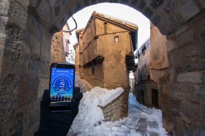

The cold snap that arrived in Spain hot on the heels of Storm Filomena will last a lot longer than expected. On Friday, 23 provinces from eight regions were still subject to warnings for low temperatures, but only one, Guadalajara, remained on red alert, the highest on a scale of three.
On Thursday afternoon, the AEMET state weather agency updated its forecasts and extended the duration of the unusually low temperatures to Wednesday of next week, meaning it will last 10 days and not four as initially predicted. “The amount of snow on the ground is such that it is preventing the temperatures from rising as was expected,” explained the AEMET spokesperson, Rubén del Campo. This 10-day period will become the longest cold snap seen in Spain in nearly 20 years.

So far, the coldest temperature registered by Spain’s AEMET state meteorological agency was seen on Tuesday, when thermometers plummeted to -25.4ºC in Bello, in the province of Teruel (Aragón region).
In the Madrid region, meanwhile, a new low was set in the satellite city of Getafe, where the thermometers fell to -12ºC on Wednesday night, according to AEMET. The previous record dates from 1945, when the temperature fell to -10.1ºC in the observatory at El Retiro park. Neighborhoods in Getafe such as Perales del Río are seeing pipes burst due to the extreme cold, despite efforts of residents to protect them.
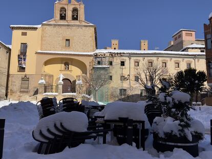
In El Retiro park, meanwhile, the temperature fell to -7.4ºC, a low unseen since 1985. In more open spaces, such as Adolfo Suárez-Barajas Airport, meanwhile, lows of -13.2ºC were registered, and -13ºC in Cuatro Vientos.
It is not easy to set new cold records in Spain, much less four back-to-back ones. Because of global warming, winters are increasingly mild and for every cold record set in Spain, there are 18 heat records, according to a recent AEMET report covering the last 10 years.
AEMET has also warned that temperatures might fall even more on Friday and Saturday in inland areas of the northeast, due to the arrival of cold air from the north, which is due to clear on Saturday. The agency predicts that the weather event will finish on Wednesday thanks to the arrival of a front from the Atlantic. This front will travel over the peninsula from west to east bringing rain with it, while a flow of air from the southwest will also raise temperatures.
English version by Simon Hunter.


