How to get the most out of your GPS navigator
In addition to getting you to your destination in the shortest time possible, these applications can also help you save money on fuel, avoid traffic jams and warn you of speed limits
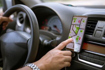

The main purpose of a GPS navigator is to guide a driver from Point A to Point B in the shortest time possible – this is how most systems are configured by default. But these sophisticated programs have many more features that can save you time and money.
Here are some tips on how to make the most of your GPS navigator.
Plan trip in advance
We typically type in the destination in our GPS navigator when we are in the car and ready to go. While there’s nothing wrong with that, it’s not the most efficient approach. By putting in the destination and your departure time the day before, the application will tell you when is the best time to leave based on the traffic history of that route. And it will advise you which routes are best to avoid. This can help you save time before you have even started the trip.
Save fuel
With the cost of gas skyrocketing, more and more drivers are selecting the cheapest route instead of the fastest. Although the difference in time may be just a few minutes, the cost savings can be significant. Applications such as Google Maps allow you to search for the most fuel-efficient route.
To calculate this, the app takes into account variables such as the distance in miles, elevation, and even the type of vehicle, i.e. whether the car is hybrid or diesel. In a blog post, Google explains that a few more minutes of driving can produce considerable savings in consumption. It also points out that the highway is not always the most fuel-efficient way to travel from one point to another.
Avoid traffic jams
GPS navigators can also save you time by helping you avoid traffic jams. These applications monitor the traffic density of any road at any given time. Using this information, the algorithm makes real-time calculations – even modifying the route mid-trip – to ensure we reach our destination in the shortest possible time. This is especially important when driving in cities, where a traffic jam can happen in a matter of seconds.
So how are navigation apps able to detect traffic in real time? Most applications use common traffic sources (usually official ones), as well as location data from individual phones. Smartphones send this information to servers, unless the user requests otherwise. And with this information, the algorithms calculate average speed, which combined with traffic history, enables the navigator to determine if there is traffic congestion and to recalculate the route.
Avoid potential speeding tickets
Respecting the speed limits is essential for safe driving. But on unfamiliar routes, we may get confused and exceed these limits. To prevent this from happening, some navigation applications warn drivers if they have exceeded the speed limit. To activate this function in Waze and Google Maps, click on the My Waze/Settings/Speedometer. Apple Maps does not alert you if you are speeding, but shows the limit on the screen.
Find out parking details
When traveling to an unfamiliar place, everything is new, and this is important when it comes to parking. By selecting satellite view in the GPS navigator, you can find out more information about how to access parking spaces and if there are parking stations in the area.
“I use Google Maps a lot to see if the parking entrances have a height sign,” explains Ricardo Colloto, a taxi driver on Twitter. “I use it to find out if I can enter with a van.”
Download maps
Depending on your destination and internet coverage in the area, your navigator may lose connection to the map. To avoid this stressful situation, it is best to download the destination area on your cellphone, so that you can continue to follow the directions.
Google Maps allows you to download certain areas to your smartphone, and will even alert you if a downloaded map is out of date. To download a map, click on the user icon at the top right, go to Offline Maps and select the area to download.
Sign up for our weekly newsletter to get more English-language news coverage from EL PAÍS USA Edition.


