The place where the Visigoth king Rodrigo was defeated by the Muslims has been located
An interdisciplinary study has located the battlefield that changed the history of the Iberian Peninsula and the stream where the monarch died, stuck in the mud
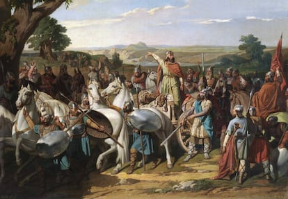

The week of July 19 through 26, 711 was crucial in the history of the Iberian Peninsula. Between those days, the decisive battle was fought between the troops of the Umayyad Caliphate of Damascus, led by Tāriq ibn Ziyad, with the Visigoth Army, commanded by King Rodrigo. The rout of the Visigoths led to the invasion of the Peninsula and a radical change in the prevailing customs and culture.
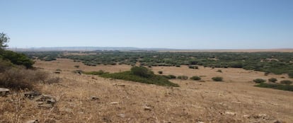
According to traditional interpretations, the battlefield was located on the banks of the Guadalete River (near Arcos de la Frontera in Cádiz province, Spain), but now the double report The battle of the Montes Transductinos: location and reconstruction of the itineraries of the battle that decided the fate of the Visigoth kingdom, published in the Spanish Association of Military History journal Atenea, places the fight on the Almodóvar River, between the Torrejosa hill (near Facinas, in Tarifa province) and the lagoon of the Janda, about 60 kilometers (37 miles) from Guadalete.
In addition to primary sources, geographical, strategic, logistical testimonies and Lidar laser technology were used to determine the exact location. For its part, another study, Drought as a possible contributor to the Visigothic Kingdom crisis and Islamic expansion in the Iberian Peninsula, published last September in the journal Nature, points to a chronic lack of rain as the main trigger of the Visigoths’ defeat.
The article in Atenea ― by José Soto Chica, Eduardo Kavanagh, Francisco José Jiménez Espejo, Mónica Camacho Calderón, Jon Camuera, Kenza Mdehheb, Ana María Berenjeno and José Turrillo ― recalls that various locations had previously been suggested, but “these proposals forget or marginalize a determining geographical fact provided by the only contemporary literary source of the events: the Mozarabic Chronicle of the year 754, which makes it crystal clear that the combat took place in the Transductinis Promonturiis (Transductine Mountains). And they completely ignore the logistics of the opposing armies and their way of fighting.”
The problem, therefore, is where the Transductine Mountains are located, which these experts did not hesitate to place around Iula Traducta (in Algeciras province) and have ruled out Gibraltar, for linguistic and documentary reasons. “They can only be the mountain ranges that form an arch that protects the bay of Algeciras from the interior. A belt of not very high mountains, but very broken, that rose like a wall between the lowlands of the bay and the marshes of the lagoon of La Janda and Barbate,” they write.
Since Tāriq “had his logistical base in Algeciras, and since Rodrigo marched against him from Córdoba, it would have to be assumed that the battle was fought at one of the points where the main roads crossed the Transductine Mountains on their route from Córdoba to Algeciras,” the article details. Furthermore, there can be no doubt that the place called El Lago, where various Arab sources say the battle took place, corresponds to the ancient and now drained lagoon of La Janda. A lagoon that was dominated by a mountain (Torrejosa hill) from which Tāriq saw King Rodrigo and his army coming.
The experts also unravel the linguistic confusion that led to the belief that the battle took place in Guadalete. “Arabic sources speak of the place as Wadi Lakko (Lake River), which was transformed into Wadi Bekka, Wadi Lakka, Wadi Lekke, Vedelac, Vadalaca, Guadalec, and Guadalete. Confusion promoted by the absence of vowels and the usual difficulty of the Arabic spelling of the time. Where LKK was originally written, it ended up being written as BKK. From which it is easy to conclude that the original hydronym was Wadi Lakko and that it cannot be Guadalete, since it was not next to the La Janda lagoon, nor on the Córdoba-Algeciras route. Confusion that would lead Archbishop Jiménez de Rada in 1243 to write it down as Vedelac or Vadalac, and which later copyists and historians of his work, like Claudio Sánchez-Albornoz, would transform into Guadalec and Guadalete.” “Albornoz is one of the great Spanish historians and no one dared to contradict him. But new advances rule out Guadalete as the site of the battle,” says Soto-Chica, professor of History at the University of Granada.
The signatories have also reconstructed the battle. “To do so, it is essential to know how many troops there were and see if the terrain fits their deployment, as well as the tactics and manner in which they fought.” Thus, a “careful reconstruction of the landscape from the beginning of the 8th century was carried out, based on paleoenvironmental studies, a meticulous analysis of the territory using plans at different scales, place names, maps from the 16th to 20th centuries, aerial photos, Lidar [laser] images, and visits.”
The Visigoths lined up in three large groups or sections: two flanks commanded by nobles and the center, led by Rodrigo. During the fight, the flanks betrayed the king, and he died alongside his faithful warriors as well as many of the traitors. The nobles who betrayed Rodrigo are named in most Arab sources as Oppas and Siseberto, brothers of King Witiza, who died 19 months earlier.
Tāriq crossed the strait first with his most veteran troops, the muqātila — Arab, Egyptian, and Syrian fighters who constituted the core of the Umayyad army and numbered 1,700 in total. Count Julian, governor of Ceuta, supported him with his fleet, allowing 7,000 more Berber warriors to disembark. There is news of a third landing, as a diversionary maneuver, carried out by Abu Zora Tarif in the place that bears his name: Tarifa. An operation with three landing points (Gibraltar, Tarifa and Algeciras) would confuse the defenders, create an operational and strategic dilemma for them by spreading their resources, and multiply the invaders’ chances of success. Eventually, after the first battle with the local forces, Musa Ibn Nusayr, governor of Umayyad North Africa, sent a final reinforcement of 5,000 men, thus leaving Tāriq with just over 13,000 troops.
The Muslim Army was composed of Berbers and troops from the Calbi tribes of Yemen, Banu Qurais of Central Arabia, Banu Gasan of Syria, Banu Lajm of Southern Iraq, and Kuwait. The Umayyad Army reached a high degree of professionalization, where Arab, Egyptian, Syrian, and Persian spearmen and archers played a key role. The Umayyads fought in close order with spearmen arranged in tight ranks. Tāriq’s army was divided into five bodies: the muqaddama or vanguard of archers, slingers, and light troops; the qalb, of spearmen in the center; the sufūf or infantrymen with chain mail on the right; the maysara or spearmen on the left; and the saqah or rearguard. They were arranged in three parallel lines and occupied about 650 yards of the front that protected a fortified camp with a moat.
The Visigoths, for their part, would have a military contingent of around 24,000 soldiers. “An imposing army for the time and with chariots that carried the equipment. Furthermore, the best of his troops were heavy cavalry,” the experts emphasize. This army was made up of three divisions, with the king in the rear surrounded by trusted men or spatharios (bodyguards). They formed mixed infantry and cavalry battalions, also arranged two or three lines deep. The battle front would extend approximately two and a half miles, “hence Tāriq’s interest in finding terrain features that would force the Visigoths to narrow the front, such as the Almodóvar river, Torrejosa hill, Alturas de Salaviciosa and Loma de la Zuya). These forced Rodrigo to give up on enveloping the enemy formations and opt for a frontal charge.”
In the year 711, the La Janda area constituted an ecosystem of lagoons and ponds deeper than in 1960, when they were drained and connected to the Almodóvar River. This landscape would explain why Rodrigo’s retreat route was cut off when his flanks betrayed him. As they retreated, the center of Rodrigo’s army was left with the swampy areas behind them. He died at the confluence of the Vico stream and the Almodóvar river, when his horse became bogged down in the mud.
The climate and the vegetation could also have been important in the reasons that led Rodrigo to tempt fate in a pitched battle. At the time of Muslims’ arrival, the Iberian Peninsula was suffering a major climatic and social crisis (famine). La Bética was the power base of King Rodrigo, who had been dux (duke) of this region before his proclamation as king, “a condition that could have been capital when it came to forcing him to return in haste from Pamplona. There, he was fighting his rivals in the civil war, risking his kingdom in a pitched battle and in the betrayal of the Witizanos when they found Rodrigo’s position especially weakened.”
A study published in Nature Communications on September 15 indicates a notable increase in plants of the genus artemisia, associated with arid climatic conditions. In fact, the combination of data from 107 pollen records taken throughout the entire Peninsula, along with others extracted from caves, the confirmation of a NAO — North Atlantic Oscillation — and a considerable decrease in solar irradiation show that the Visigoth kingdom was going through a severe climate crisis defined by a formidable drought, probably one of the worst in 5,000 years, and a great drop in temperatures. In a world governed by the success or failure of harvests, such climatic conditions led the population to suffer tremendous famines, provoked social and political confrontations, and favored the spread of pandemics. The most reliable ancient Arab sources point out the effect of all of the above: the death of half of the population in the days prior to the arrival of Tāriq. Miguel Ángel Cuadrado, a specialist in ceramics from the Al-Andalus era at the Guadalajara Museum, highlights that the interdisciplinary discoveries made in recent years thanks to technology “make it possible to change our perception of historical events that were taken for granted. And this is one of those cases.”
The toponymy of the area seems to keep memory of previous war operations. Thus, for example, the place names of Arráez Alto and Arráez Bajo appear on the battlefield, arráez being the Spanish form of rais, the name that victors were called in the Arabic language. For seven days, both armies faced each other in skirmishes. “All this, not to mention that there persists an ancient tradition in nearby Facinas that is treasured by its parish priests that King Rodrigo was buried there.” Because it is not known where the body of the dethroned king is, although now we know where he died. Stuck in the mud.
Sign up for our weekly newsletter to get more English-language news coverage from EL PAÍS USA Edition
Tu suscripción se está usando en otro dispositivo
¿Quieres añadir otro usuario a tu suscripción?
Si continúas leyendo en este dispositivo, no se podrá leer en el otro.
FlechaTu suscripción se está usando en otro dispositivo y solo puedes acceder a EL PAÍS desde un dispositivo a la vez.
Si quieres compartir tu cuenta, cambia tu suscripción a la modalidad Premium, así podrás añadir otro usuario. Cada uno accederá con su propia cuenta de email, lo que os permitirá personalizar vuestra experiencia en EL PAÍS.
¿Tienes una suscripción de empresa? Accede aquí para contratar más cuentas.
En el caso de no saber quién está usando tu cuenta, te recomendamos cambiar tu contraseña aquí.
Si decides continuar compartiendo tu cuenta, este mensaje se mostrará en tu dispositivo y en el de la otra persona que está usando tu cuenta de forma indefinida, afectando a tu experiencia de lectura. Puedes consultar aquí los términos y condiciones de la suscripción digital.


