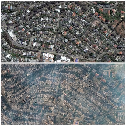
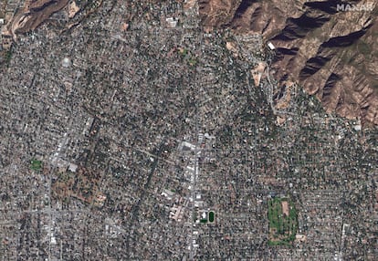
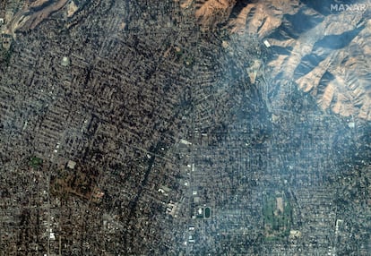
Satellite images reveal the scale of devastation from Los Angeles wildfires
The fires have scorched more than 60 square miles of the Californian city area and have damaged or destroyed at least 11,000 structures
The worst fires in the history of the U.S. city of Los Angeles have claimed at least 24 lives and scorched more than 60 square miles. Of the three fires that broke out on January 7, the largest is the so-called Palisades Fire, spanning 37 square miles. Satellite images from the ESA clearly reveal the extent of the fire: healthy vegetation is highlighted in green, while charred areas appear in red.
The following table contains the main figures on the number of structures damaged and hectares
Evacuations in California have affected approximately 175,000 people, out of a total population of over nine million in Los Angeles County.

The devastating consequences of the fire are also a reflection of the areas where it has spread: densely populated neighborhoods with many single-family homes.
The following graph compares the extent of the fires currently active in California with the largest fire ever recorded in the state: the August Complex fire. This blaze, caused by dozens of outbreaks triggered by an electrical storm, eventually merged into a massive blaze in northern California in 2020. The graph also compares it with other fires, such as those that ravaged the Culebra mountain range in Zamora, Spain, in the summer of 2022.
Also burning north of Los Angeles is the Eaton Fire, which, though covering a smaller area (22 m²), has affected more homes. Over 6,500 residences have been damaged or destroyed, according to damage analysis by Corey Scher (CUNY) and Jamon Van Den Hoek (Oregon State University). The fire has had a severe impact on the population of Altadena, where many homes, built with wooden structures due to the material’s availability and low cost, have been reduced to ashes. In 2019, 90% of homes in the area were built with wooden foundations.
The Eaton wildfire is now the fifth deadliest in California history. Of the 24 deaths recorded so far this week, 16 have died in this blaze.


Sign up for our weekly newsletter to get more English-language news coverage from EL PAÍS USA Edition