Tornado emergency issued for Little Rock and nearby areas
The National Weather Service warns that 350,000 are in danger from a ‘confirmed large and destructive tornado’

The National Weather Service issued a tornado emergency for Arkansas’s capital of Little Rock and surrounding areas on Friday, warning that 350,000 people are in danger from a “confirmed large and destructive tornado.”
Forecasters say “a large and destructive” tornado touched down Friday afternoon in Little Rock and North Little Rock. The violent twister was seen in video posted online plowing through neighborhoods and business districts of Little Rock and surrounding areas. Aerial footage showed several rooftops reduced to splinters in Little Rock and nearby Benton, vehicles were toppled over and debris was scattered across roadways.
There were no immediate reports of injuries. Passengers and airport employees at Clinton National Airport in Little Rock took shelter in bathrooms.
Massive storms brewing over at least 15 states in the Midwest and southern U.S. on Friday have meteorologists urging people to brace for dangerous weather including tornadoes, saying the conditions are similar to those a week ago that unleashed a devastating twister that killed at least 21 people in Mississippi.
More than 85 million people were under weather advisories Friday as the National Weather Service’s Storm Prediction Center forecast an unusually large outbreak of thunderstorms with the potential to cause hail, damaging wind gusts and strong tornadoes that could move for long distances over the ground.
The area at greatest risk for storms on Friday follows a large stretch of the Mississippi River from Wisconsin all the way to Mississippi, with rare high-risk advisories centered around Memphis; and between Davenport, Iowa, and Quincy, Illinois and surrounding areas.
Forecasters issued tornado watches over both high-risk regions until Friday evening, with the weather service expecting numerous tornadoes and calling it a “particularly dangerous situation.”
All told, by Friday afternoon, tornado watches issued by the National Weather Service cover most of Missouri, Arkansas and Iowa; western Illinois; and parts of Wisconsin, Texas, Tennessee, Kentucky and Mississippi. Tornado warnings were issued for isolated areas of Arkansas, Missouri and Illinois on Friday afternoon.
The “intense supercell thunderstorms " predicted for Friday afternoon are only expected to become more common, especially in Southern states, as temperatures rise around the world.
Apart from Little Rock, the major population centers at high risk for storms starting Friday afternoon include Chicago; St. Louis; Jonesboro, Arkansas; and Des Moines and Cedar Rapids, Iowa.
“There will be lots of thunderstorms ... tornadoes, damaging winds, and large hail,” said Northern Illinois meteorology professor and tornado expert Victor Gensini.
People in those areas should stock emergency supplies, prepare for power outages, avoid getting stranded in places vulnerable to falling trees or severe hail, and park vehicles in garages if possible, meteorologists said.
Forecasters warned of a “relatively rare, significant severe weather threat” around Chicago that could include powerful winds, tornadoes and large hail.
In Iowa City, the University of Iowa canceled Friday’s watch party for fans who planned to gather for the women’s basketball Final Four game against South Carolina. Deputy Director of Athletics Matt Henderson said in a statement the decision was made “due to the unpredictable timing of possible severe weather and potential storm impact.”
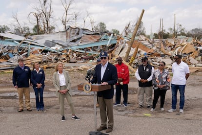
Last Friday night, a vicious tornado in Mississippi killed at least 21 people, injured dozens and flattened entire blocks as it carved a path of destruction for more than an hour. About 2,000 homes were damaged or destroyed, according to the Mississippi Emergency Management Agency.
The toll was especially steep in western Mississippi’s Sharkey County, where 13 people were killed in a county of 3,700 residents. Winds of up to 200 mph (322 kph) barreled through the rural farming town of Rolling Fork, reducing homes to piles of rubble, flipping cars and toppling the town’s water tower.
Gensini said Friday’s atmospheric setup is similar to the conditions that were present during Mississippi’s deadly storm.
The hazardous forecast is a result of strong southerly winds transporting copious amounts of moisture from the Gulf of Mexico north, where they will interact with the strengthening storm system.
In South Dakota, Governor Kristi Noem ordered state executive branch offices to be closed Friday in parts of the state, as freezing rain, snow and high winds were expected. Many counties were under blizzard or ice storm warnings.
The weather service is forecasting another batch of intense storms next Tuesday in the same general area as last week. At least the first 10 days of April will be rough, Accuweather meteorologist Brandon Buckingham said earlier this week.
Bill Bunting, the weather service’s Storm Prediction Center chief of forecasting operations, said people need to have a severe weather plan in place that includes multiple ways to receive storm warning information.
“We’ve all seen the coverage of the heartbreaking situations in other parts of the country. Our fervent hope is that people pay attention to the forecasts that have been out for several days now regarding Friday’s threat,” Bunting said.
Sign up for our weekly newsletter to get more English-language news coverage from EL PAÍS USA Edition
Tu suscripción se está usando en otro dispositivo
¿Quieres añadir otro usuario a tu suscripción?
Si continúas leyendo en este dispositivo, no se podrá leer en el otro.
FlechaTu suscripción se está usando en otro dispositivo y solo puedes acceder a EL PAÍS desde un dispositivo a la vez.
Si quieres compartir tu cuenta, cambia tu suscripción a la modalidad Premium, así podrás añadir otro usuario. Cada uno accederá con su propia cuenta de email, lo que os permitirá personalizar vuestra experiencia en EL PAÍS.
¿Tienes una suscripción de empresa? Accede aquí para contratar más cuentas.
En el caso de no saber quién está usando tu cuenta, te recomendamos cambiar tu contraseña aquí.
Si decides continuar compartiendo tu cuenta, este mensaje se mostrará en tu dispositivo y en el de la otra persona que está usando tu cuenta de forma indefinida, afectando a tu experiencia de lectura. Puedes consultar aquí los términos y condiciones de la suscripción digital.


