The Ukraine war in maps: Ukrainian forces battle to recover Snake Island
The Kremlin’s forces are reinforcing their positions around the Donbas area and continue to put pressure on defenders with relentless strikes
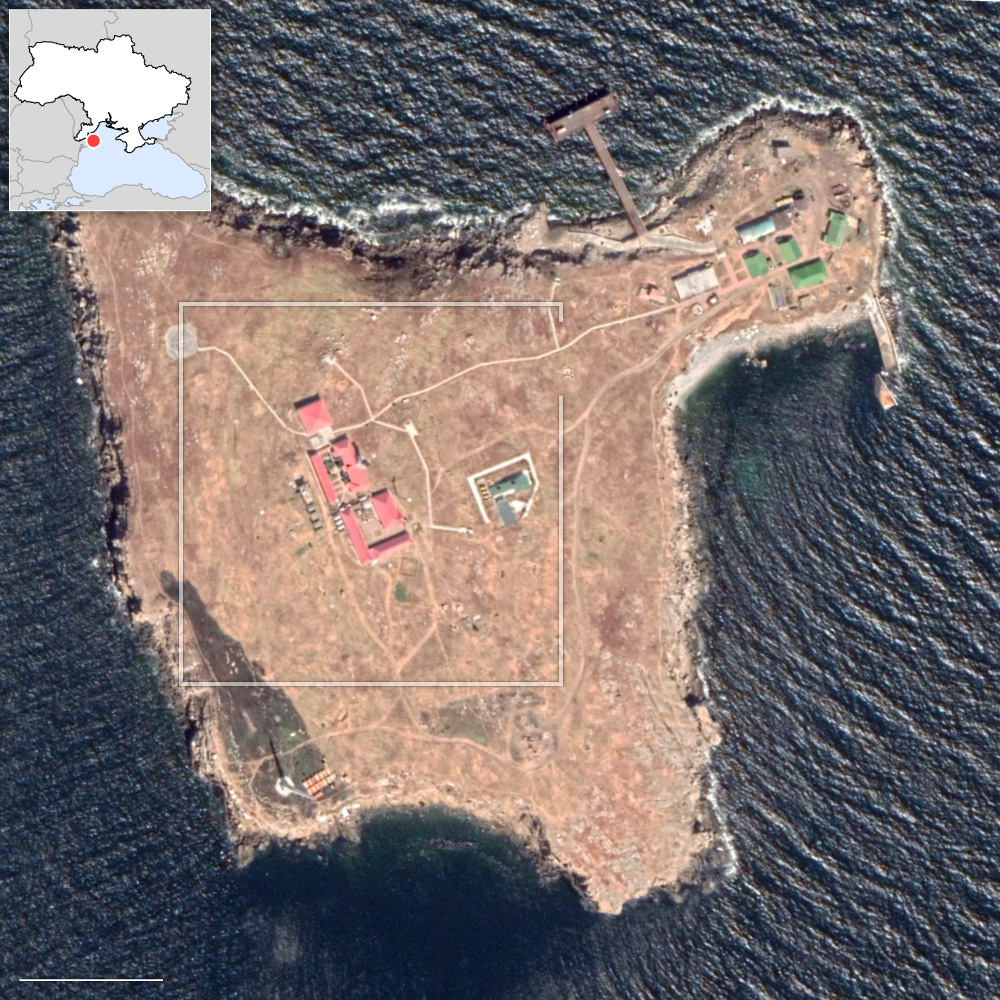
May 13 | The battle for Snake Island
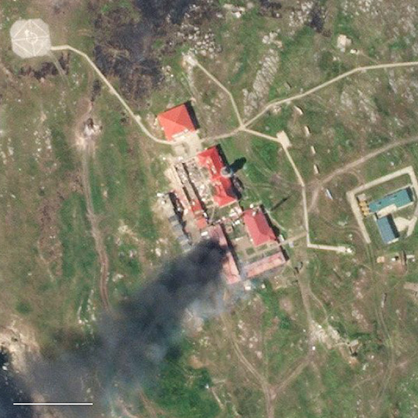
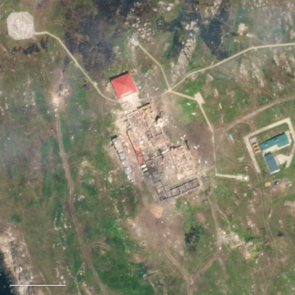
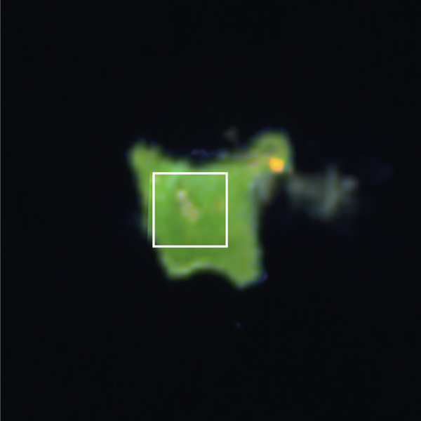
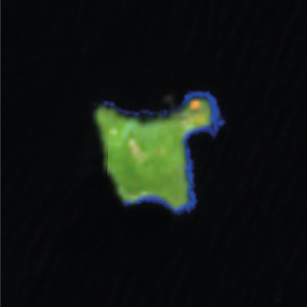
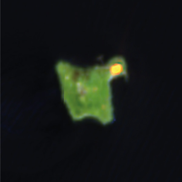
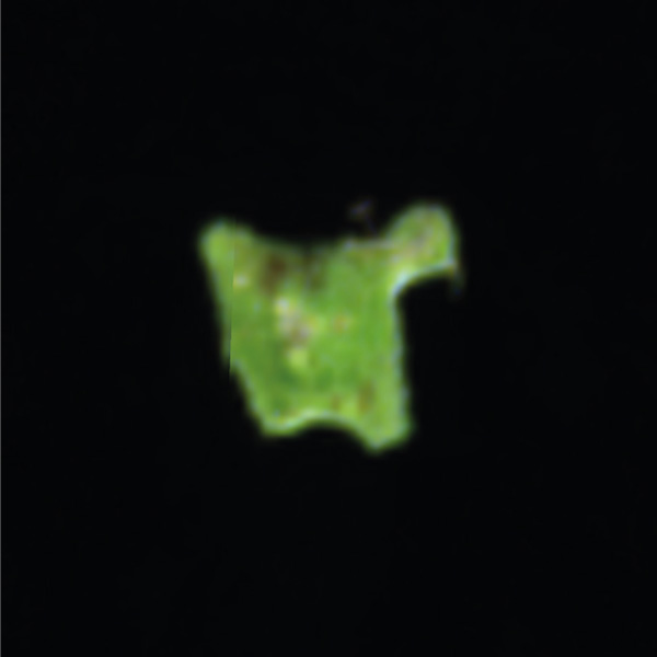
The all-out attack that Russian troops deployed at the beginning of the offensive in Ukraine did not leave out maritime control of the Black Sea: the Kremlin’s naval force soon took up positions the island of Zmiinyi, also known as Snake Island and located around 140 kilometers (87 miles) south of Odessa and 40km (25 miles) from the Romanian coast. The first map of the conflict published by the Institute for the Study of War (ISW) on February 25 showed it under Russian control even then. In a statement in February, the Ukrainian Navy said that the invaders had destroyed infrastructure on this island of one square kilometer. A comparison of satellite images captured before the invasion and in recent days shows that the destruction of the main building occurred between May 6 and 7.
Pier
Facilities
Detail
SNAKE ISLAND
Facilities
100 m
Areas burnt by earlier attacks
Visible structural
damage
Lighthouse
50 m
Destroyed buildings
50 m

Destroyed
buildings
Area of attack
on helicopter
(shown in video)
100 m
British intelligence warned last Tuesday that if Russian troops consolidate their position on the island, deploying air defense cruise missiles, they could control the northwest portion of the Black Sea. The permanent Russian settlement on Snake Islands entails sea, land and air control of that entire area, military strategy expert Oleh Zhdanov told the BBC.
The strategic importance of the islet, which grants control over maritime traffic in the port of Odes, is enough to justify the ongoing struggle for it. The Russian Defense Ministry has claimed that it destroyed several planes, helicopters, drones and a landing craft in the early hours of Sunday morning during a Ukrainian attempt to recapture the island. Ukraine claimed that it only attacked Russian troops deployed there. British intelligence stated that Ukraine has used drones to destroy Russian anti-aircraft defenses and supply ships, stranded after the invaders retreated to the Crimean coast following the sinking of the Moskva, the flagship of Russia’s Black Sea fleet.
The sensors of the European Space Agency’s Sentinel-2 satellites have made it possible to observe hot spots on the island which, in the context of war, can be associated with attacks. These indications of attacks have been recurrent since last February, and particularly intense during the last weekend, coinciding with a video of an attack on the island.
The proximity of Zmiinyi to NATO coasts has not prevented it from becoming a battlefield in the conflict. Armand Gosu, a professor of Russian Political History at the University of Bucharest, explained to Efe news agency that Moscow categorically dominates the Black Sea: “There is a huge military imbalance. Its ships patrol international waters without restriction, which has allowed the Russians to block a maritime outlet from Odessa,” he said. This blockade stifles Ukrainian sea exports that are essential to defend the coastal town from a hypothetical Russian siege like the one suffered by Mariupol.
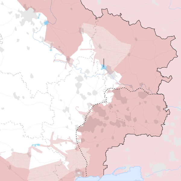
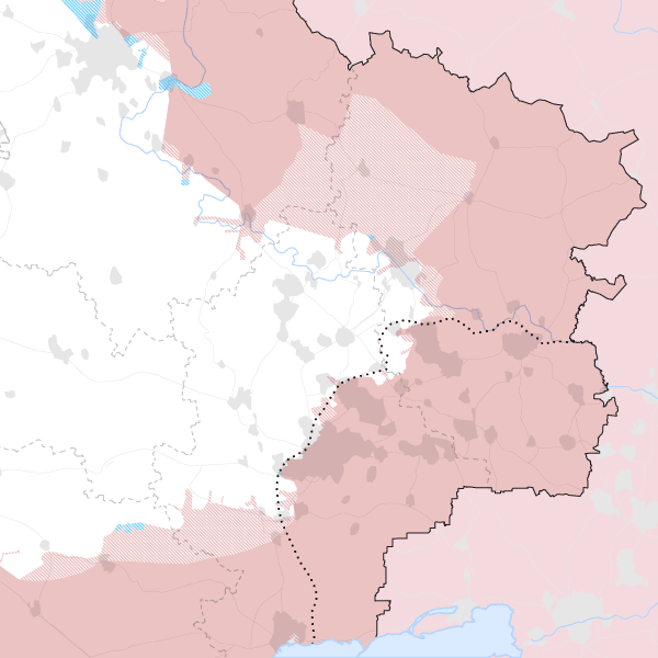
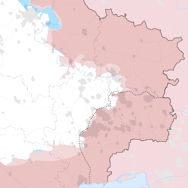
May 10 | Russian progress
In the two and a half months since the start of the Ukraine invasion, the Russian offensive has changed strategies: at first it sought to take control of the major cities, then focused its efforts on the separatist region of Donbas and on securing the borders. Since then, the frontline has moved in line with modest but systematic Russian advances that have only met with resistance at a spot that’s been highly militarized since 2014, when Russia annexed the Crimea peninsula. The change in the frontline can be seen in the following maps, which show the situation on the ground every two weeks since Russia changed its strategy on March 25. The red color shows areas under Russian control, which have been expanding for the last month and a half.
Donbas is an area covering around 52,000 square kilometers, roughly the size of Costa Rica. It is divided into two oblast (administrative units) – Donetsk and Luhansk. Along the northwest, it borders the Kharkiv region, home to the city of Izyum, which is the starting point for Russia’s attempt to encircle Ukrainian defenders holding the frontline. From there, Russian troops have been trying to advance towards Sloviansk and Kramatorsk, the military headquarters and de facto capital of Donetsk, although they have had limited success.
Kharkiv
Russian
control
Russian
advance
Izyum
Severodonetsk
UKRAINE
Luhansk
DONBAS
Donetsk
RUSSIA
40 km
Mariupol
Kharkiv
RUSSIA
Ukrainian
counterattack
Izyum
Severodonetsk
UKRAINE
Luhansk
DONBAS
Donetsk
Mariupol
Kharkiv
RUSSIA
Izyum
Severodonetsk
UKRAINE
Luhansk
DONBAS
Donetsk
Mariupol
Kharkiv
RUSSIA
Izyum
Severodonetsk
UKRAINE
Luhansk
DONBAS
Donetsk
Mariupol
The Institute for the Study of War (ISW) believes that the Kremlin’s forces near Izyum are regrouping and resupplying before resuming offensive operations in the southeast and southwest.
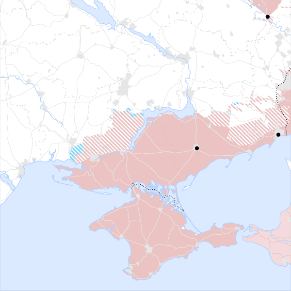
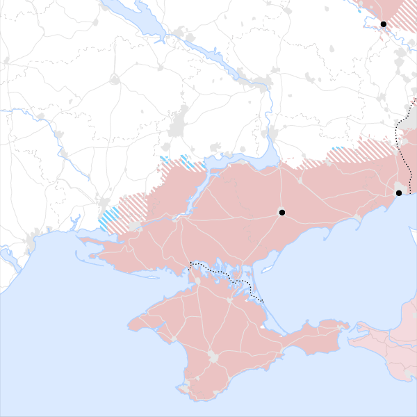
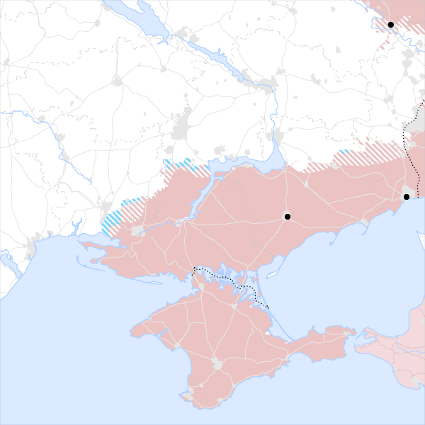
In the south of the country, near Crimea and the Black Sea, there is a similar situation: slow but constant Russian advances and reinforced positions in places like Kherson, which was swiftly captured in the early days of the invasion. Ukrainian counterattacks have barely made a dent on Russian forces, who have increased the territory under their control week after week. Moscow has been concentrating anti-aircraft and missile systems in the northern area of Crimea, said the ISW. This could be a prelude to resume offensive operations towards Zaporizhzhia and Kryvyi Rih, in central Ukraine.

Izyum
Dnipro
UKRAINE
Zhaporizhia
Mariupol
Melitopol
Kherson
Odessa
Sea of Azov
CRIMEA
RUSSIA
Black Sea
100 km
Izyum
Dnipro
UKRAINE
Zhaporizhia
Mariupol
Melitopol
Kherson
Odessa
Sea of Azov
CRIMEA
RUSSIA
Black Sea
Izyum
Dnipro
UKRAINE
Zhaporizhia
Mariupol
Melitopol
Kherson
Odessa
Sea of Azov
CRIMEA
RUSSIA
Black Sea
Izyum
Dnipro
UKRAINE
Zhaporizhia
Mariupol
Melitopol
Kherson
Odessa
Sea of Azov
CRIMEA
V
Black Sea