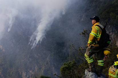
Heat waves in Chile and Argentina, fires in Colombia: What is happening in South America?
Bárbara Tapia Cortés from the World Meteorological Organization explains how El Niño and global warming are affecting the region


In South America you feel the heat. During the past week, meteorological teams in different cities recorded high temperatures. Between January 21 and 25, there was a heat wave in central southern Chile and Argentina, as well as in central Colombia. In Santiago de Chile, the mercury hit 98.1°F, the third highest recorded temperature in 112 years.
And in Colombia, where the government declared the forest fires the country is currently fighting a natural disaster, several municipalities also reached temperatures above average: 104.7ºF in Jerusalén; 99.7ºF in Sahagún, and 98.4ºF in the coastal city of Santa Marta. With temperatures reaching 78.5°F last Monday, Bogotá also broke a historical record.
The scenario has provoked alarm, and there are questions about how to interpret what is happening. In this interview, meteorologist Bárbara Tapia Cortés — who is also the technical coordinator of Services at the Regional Office of the World Meteorological Organization (WMO) for the Americas, based in Asunción (Paraguay) — sheds light on how climate change and the current El Niño weather phenomenon have played a role in driving these conditions.
Question. Could it be stated that records for high temperatures in South America have been broken over the last few days?
Answer. It is true that high temperatures were recorded last week. But there is not always enough data to determine whether records were indeed broken, since there are either absolute, historical records since records began, or there are monthly records, which in other words means checking to see if January 2024 has been one of the warmest on record. For example, 98.1°F was recorded in Chile last week, which is the third highest temperature recorded in January in 112 years.
With the current trend of climate change, different rankings are being drawn up, such as the highest temperatures in the last 10 years. But to assert that South America as a continent broke a record is not correct. To know specifically where this happened, you have to consult the meteorological services of each country directly, since they have the respective climate statistics that require at least 30 years of data.
Q. Likewise, the month of January is usually a hot month in the region, isn’t it?
A. Yes. Because it is summer in the entire region, and it is normal for us to have high temperature events. It’s always been like that. What is abnormal is that we have this reiteration or persistence of high temperatures, which is closely related to the El Niño phenomenon.
Q. What role is this phenomenon playing in these high temperatures?
A. This increase in temperature, which as I said, is a normal situation for the summer season, has been exacerbated by the El Niño phenomenon. It has been present since May 2023 and is reaching its maximum between the months of December and January. It is a situation that tends to increase extremely high temperature events and, therefore, causes heat waves throughout South America.
Due to the influence of El Niño, it is expected that the summer season in the region may register maximum temperatures that are above normal values for the season and that it will also present accumulated precipitation below normal, especially in the north such as in Colombia, Venezuela, Suriname, the Guyanas, and some areas of Brazil.
It is worth remembering that we are emerging from 2023, which was the warmest year ever recorded, and it is likely that the warming effect of the current El Niño episode will intensify the heat even more during 2024. This will cause even more extreme weather events that will ruin more lives and destroy livelihoods.
Q. And how is all this related to climate change?
A. You have to understand that the El Niño phenomenon is always characterized by the surface temperature of the ocean. Monitoring it is done mainly in the central strip along the equator, in the middle of the Pacific Ocean. But what has happened? Recent El Niño events, including this one, are being created from an ocean that is already warmer. It is as if you had a tub with hot water and you put more hot water in it, rather than a tub with warm water and you put hot water in it. It’s something like that. So we know this: the El Niño that is now affecting us came about in very warm conditions, but we do not yet know how to measure the way in which it will affect us, or how extreme it will be.
Now, what we do know and what the Intergovernmental Panel on Climate Change (IPCC) itself has said is that, as each year seems to be warmer than the previous one, extreme events — not only high temperatures, but also precipitation and other conditions — will become more frequent and more extreme. So what we can say is that the El Niño phenomenon that is affecting us right now has been influenced or exacerbated by global warming. And that implies that it will cause more damage to the population.

Q. Colombia declared a national emergency due to forest fires. There are also several outbreaks in Chile and Argentina. Although in some cases there are indications that the fires were started intentionally, what other causes could there be? How are weather conditions exacerbating them?
A. The prevailing meteorological conditions with high temperatures, low humidity content — atmospheric and soil — and sometimes moderate wind, greatly increase the likelihood of wildfires breaking out, especially during the summer months. As of January 25, 2024, there were 81 wildfires in Chile, of which six were being monitored, 15 were being fought, 55 had been brought under control, and five had already been put out. The fires have affected an area of over 2,820 acres. But, if high temperatures continue, these outbreaks will persist and could even increase during the summer. Meanwhile, in Colombia, high temperatures have kept nearly 900 municipalities on alert due to the risk of forest fires.
Q. An extreme heat wave has also been reported in Argentine Patagonia. What is happening there, and what could be the consequences of this heat wave?
A. High temperatures were recorded in Argentine Patagonia, with 111ºF in San Antonio Oeste, 108.5ºF in Cipolletti, 106.9ºF in Neuquén and 104.9ºF in San Juan. It is worth remembering that when we talk about a heat wave, we mean that extremely high temperatures are recorded for three or more consecutive days. This is why they pose a risk to people’s health.
Between 2000 and 2019, an estimated 489,000 people died each year due to heat. With very high maximum temperatures and also high minimum temperatures, the human body has greater difficulty dissipating heat, which affects the physiology of the human body and can produce serious consequences for people. A very important point to remember is that heat does not affect all people equally. There are certain social groups that are particularly vulnerable: older adults, children under five years of age, people with heart, kidney, and mental diseases, or those who are at greater risk of suffering the consequences of heat. Likewise those who live alone and are isolated, those who live in precarious housing conditions, and those who work outdoors.
Q. How long is region expected to experience these high temperatures?
A. The occurrence of extreme events — such as heat waves — could continue during much of the summer and the first months of autumn in the southern hemisphere, that is, until April or May on average. But we must remember that the intensity of the temperatures is related to the seasons. In addition, the climate models of the Forecast Centers worldwide are estimating that the influence of El Niño should continue until the March-April-May quarter of 2024.
Q. Could this data indicate that 2024 will surpass 2023 as the warmest year on record, or is it too early to speculate?
A. It is still early to state that 2024 will be warmer than 2023, given that El Niño years are directly related to the global increases in temperatures recorded in recent decades. But the WMO, and like the Global Forecast Centers, are constantly monitoring conditions, given that after El Niño normal conditions are expected to persist, but we are just about to end January so it is very risky to give a forecast.
Sign up for our weekly newsletter to get more English-language news coverage from EL PAÍS USA Edition


