Building a Google Maps for the ocean
Maritime navigation involves accounting for marine currents, varying wave conditions, and shifting winds
Two recent events highlight the importance of selecting optimal maritime navigation routes. First, attacks on vessels in the Red Sea has led shipping companies to opt for the longer Africa route instead of going through the Suez Canal. Is it possible to find a fastest and more fuel-efficient path along that Africa route? Second, a large wave caused the Toconao ship to lose its cargo of plastic pellets off the northwest coast of Spain, raising concerns about the environmental impacts. What’s the safest navigation route in rough weather to avoid such accidents? Mathematical optimization techniques can provide answers to these questions.
These optimization techniques, studied by renowned mathematicians like Euler, Lagrange and the Bernoulli brothers, help us determine the best route between two points based on a goal — speed, cost-efficiency or safety. The shortest distance isn’t always the best choice. For instance, taking the highway might be quicker than a shorter local road for a faster car trip.
In maritime navigation, we need to consider ocean currents and constantly changing waves and winds. The first person to tackle this problem was German mathematician Ernst Zermelo (1871-1953). He was able to calculate the quickest route between two points for a boat moving at a steady pace, taking into account changing winds and currents.
To ensure your solution is practical and useful for real navigation, reliable predictions of navigation conditions are essential. The U.S. National Oceanic and Atmospheric Administration (NOAA) and Europe’s Copernicus center provide detailed 10-day forecasts with high spatial accuracy (under 10 kilometers). Modern meteorological models have taken great strides, and today’s five-day forecast is more reliable than the one-day forecast in 1980. This progress is due to more atmospheric observations. Mathematical disciplines like statistics, Kalman filters (linear quadratic estimation) for data assimilation, partial differential equations for modeling atmospheric dynamics, and numerical methods play crucial roles. Artificial intelligence is now enhancing results further, as shown by Google DeepMind researchers.
Additionally, providing a detailed description of the ship’s movement can lead to improved solutions. This involves modeling the movement and fuel consumption of each ship based on factors like navigation conditions, currents, wave height, wind angle and intensity. This process utilizes knowledge from naval engineering and data science.
With this information, innovative mathematical optimization algorithms have been developed, such as the so-called variational methods, graph optimization and evolutionary algorithms. All of them are used today to find favorable sea routes.
But all predictions come with a measure of uncertainty, which needs to be factored in when optimizing navigation routes. To handle this, new optimization algorithms — dynamic and stochastic — are needed to produce robust results in various atmospheric conditions. This is crucial, especially in a scenario of global warming with an increasingly unstable atmosphere and more frequent extreme weather events.
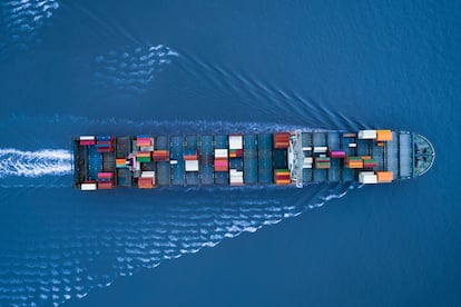
All of the mathematical techniques mentioned above have been recently incorporated to optimize maritime routes in real time (based on meteorological and oceanographic predictions) with models adapted to each individual vessel. This tool, which aims to be a Google Maps for the ocean, is being developed by a multidisciplinary team from various countries, including many Spaniards. The tool will enable fuel savings of 5-10% on each trip, improve navigation safety by avoiding areas with adverse conditions, and reduce carbon dioxide emissions. All of this is crucial since over 80% of the world’s trade volume is transported by sea, which accounts for nearly 3% of global carbon dioxide emissions. Annual spending on fuel amounts to $270 billion (€250 billion) and accounts for more than 60% of the operating costs of maritime transport.
David Gómez-Ullate is a professor of applied mathematics at IE University in Madrid and director of the Green Navigation project.
David Martín De Diego is a scientific researcher at Spain’s Institute of Mathematical Sciences (CSIC).
Sign up for our weekly newsletter to get more English-language news coverage from EL PAÍS USA Edition


