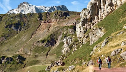
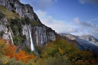
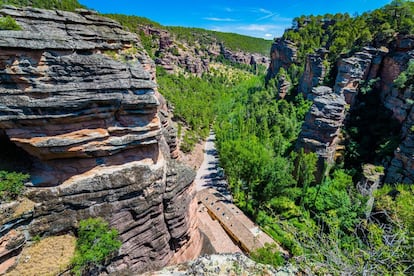
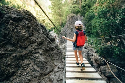
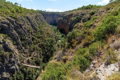
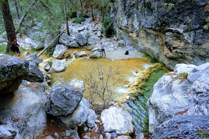
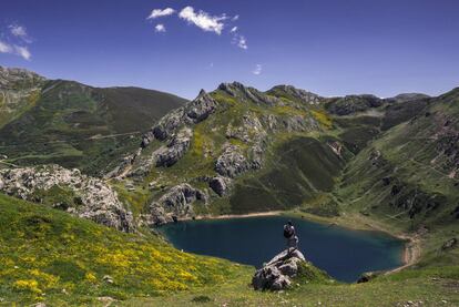
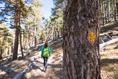
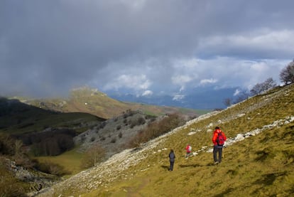
The Asón River springs from the side of the mountain and tumbles over a cliff some 70 meters high (above). Legend has it that this is the silver hair of a Cantabrian nymph – anjana – from Cantabrian mythology who has been trapped in the rocks. Known as the Cailagua, this spectacular waterfall is reached by a 9.4 km trail known as the Asón trail that starts in Asón in the Soba valley and weaves through fairytale beech, oak and chestnut forests. Part of Los Collados del Asón Natural Park, the trail is easy and one of the most popular in Cantabria. More information: altoason.comGettyProviding the setting for José Luis Sampedro’s novel Where the River Takes Us, the canyons and gorges in the Alto Tajo Natural Park between Cuenca and Guadalajara are crossed by 11 official routes as well as nine specialized geo-routes that explore its geological features. The levels vary but there are easy trails, such as the Barranco del Horcajo route that weaves between towering rocks; the Laguna de la Salobreja route that starts on the outskirts of Orea in Guadalajara; or the Valle de los Milagros route that passes the cave of the Casares. Above, you can see the Santuario de la Vírgen de la Hoz on the banks of the Gallo River in Ventoso. More information: turismocastillalamancha.esM. RAMÍREZ (ALAMY)This trail is six kilometers long and involves a moderate 250-meter climb. It also has magical beech forests, turquoise pools and waterfalls that punctuate the course of the Urederra River. Starting in the town of Baquedano, it takes you to the source of the river that springs from a cliff in the Urbasa natural park. Only 450 people can enter the park daily and in high season there is also a charge for parking in the town. More information in nacederourederra.com and bookings in administracionelectronica.navarra.esGETTY IMAGESThis beautiful hike in Matarraña is divided into three parts: a six kilometer climb by a tarmac road to the town of Beceite – where you can park for a fee – that takes you to the entrance of the natural park; several kilometers of dirt track, that takes you past the Fenellassa rock paintings and amazing flora; the actual eight-kilometer Parrizal trail, which starts at a wooden footbridge and takes you along the river until the Els Estrets del Parrissal canyon. Swimming is not allowed. More information: beceite.esFERRAN TRAITE (GETTY)The Pantaneros trail (above) is little more than five kilometers and takes you through the gorges of the Turia River. This was the trail used by workers walking from Chulilla in the Valencia region to the Loriguilla reservoir, which they built in the 1950s. The trail winds along the tops of cliffs 80 meters high and crosses the gorges by two hanging bridges. It also takes in riverside forests and Mediterranean scrub and two of the regions main landmarks – Los Calderones and el Charco Azul. Possibly not the best trail for small children or those suffering from vertigo. More information: chulilla.esREMIGIJUS TVERIJONAS (GETTY)The Cahorros del Río Chillar hike in Nerja is one of the most popular in the Málaga region as, besides its beauty, it provides a breath of fresh air in the summer months. It is also easy, at least until you reach the first well. After that, it becomes more challenging. The walk to the well is 10 kilometers – five there and another five back. But the complete hike is 16 kilometers and takes you to the Vado de los Patos. It’s best to avoid peak season as the experience of walking up river with the water up to your ankles and the birds singing above you might be somewhat spoiled by too much company. More information: malaga.esJOHANNES SCHWANBECK (Flickr)The Lobos River has been running through this protected valley for aeons, forming a deep canyon that walkers can cross using a number of trails. One that is recommended is the 14 kilometer route that starts at Torcón and crosses the sierra and the Torcón canyon, ending at the Castalago viewpoint close to Hontoria del Pinar, Burgos. But the most popular is the so-called River Route (above) that crosses the canyon from below and takes hikers 25 kilometers to the San Bartolomé heritage. This route can be cut to 10 kilometers by starting at the Siete Ojos bridge in Soria. More information: turismocastillayleon.comJORDI PASTORIn 2015, Skyscanner users included the Saliencia Lake trail in the Somiedo Biosphere Reserve in Asturias among the 27 best walking routes in Spain. The trail links four glacier lakes – Calabazosa or Lago Negro, Cerveriz, Laguna de Almagrera or La Mina, and La Cueva – that lie between the Alto de La Farrapona and the Valle del Lago. There are two alternatives: a short hike of around 7 kilometers that takes you as far as the lakes and then back to Farrapona which is easy enough for kids; and the longer option which covers 14 kilometers and goes to the Valle del Lago – this, for intermediate level hikers. More information: turismoasturias.esCARLOS F. TURIENZO (GETTY)This is a classic trail in the Sierra de Guadarrama that is named after the Austrian mountaineer Eduard Schmidt – or Schmid – who established it in 1926. It starts in the Puerto de Navacerrada and ends in the Royal Spanish Society of Mountaineering hostel in Peñalara, both of which are in the Madrid region, though most of the route lies to the north of the Siete Picos in Segovia. The Schmid Way does enter Madrid at the meeting point Collado Ventoso, passing to the south of it en route to Fuenfría in Cercedilla. Eight kilometers long and without too much of a climb, it takes in springs, streams, pine forests and meadows. More information: madrid.orgThe Gorbea Natural Park (above) is the biggest park in the Basque Country, running along the border between Álava and Vizcaya. It has a network of 14 routes ranging from easy to advanced. The Altube route, for example, starts in Altube in Zuya, Álava, and covers 7.2 kilometers ending in the Txinxtularra countryside and the Burdona mountain range. The route goes through beech forest to the hills of Lekandai, from where you can see the trail winding down to the Bayas River. For more information: turismo.euskadi.eusJUAN CARLOS CANTERO (GETTY)