Hague court awards Peru chunk of maritime waters outside 80-mile limit
Decision puts an end to a long-running dispute between governments in Lima and Santiago
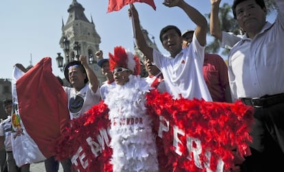
In a long-awaited ruling that has had Peruvians and Chileans on edge for the past several months, the International Court of Justice (ICJ) on Monday changed the maritime boundaries in the Pacific, giving more territorial waters to Lima.
However, the justices at The Hague decided not to determine the precise demarcation coordinates that Peru had been demanding and left both countries to decide this matter.
The ICJ drew a parallel boundary 80 miles out from the coasts of both South American nations but gave Peru a big chunk of maritime area as the line was drawn in a southwesterly direction to complete the internationally recognized 200-mile territorial waters limit.
At a hearing that was carried live in Peru and Chile, ICJ Chief Justice Peter Tomka showed a graph where Peru’s new maritime territory starts, from the 80-mile demarcation line and the line drawn downward out to sea.
Both presidents, Ollanta Humala of Peru and Sebastián Piñeda of Chile, had said they would respect the decision.
Former Peruvian Foreign Minister Allan Wagner, who had been his country’s representative in the dispute at The Hague, said he felt “proud and honored” by Monday’s ruling, according to the Lima daily El Comercio.
His Chilean counterpart, Alberto Van Klaveren, appeared perplexed over the new maritime limits.
“The court’s decision is binding and both nations have committed themselves to comply with it. Now we have to analyze it deeply so that we can examine what it is based on and how far this decision will reach. We will carry this out under the fundamentals of international law,” he was quoted as saying in Santiago’s El Mercurio.
Peru had filed a lawsuit in 2008 against Chile claiming some 38,000 square-miles of rich fishing grounds in the Pacific. Specifically, Lima wanted a straight demarcation line from their common borders out to sea.
But while the ICJ awarded Peru about half of the water rights its government was claiming, the bulk of valuable coastal fishing grounds remain with Chile.
“In view of the circumstances of the present case, the court has defined the course of the maritime boundary between the parties without determining the precise geographical co-ordinates,” states the 71-page ruling that Justice Tomka read. “Moreover, the court has not been asked to do so in the parties’ final submissions. The court expects that the parties will determine these co-ordinates in accordance with the present Judgment, in the spirit of good neighborliness.”
Chile had argued that treaties signed in 1952 and 1954 both agreed to the current maritime limits – a straight 200-mile line out to sea. But the Peruvian government had described those treaties as mere fishing agreements.
Tu suscripción se está usando en otro dispositivo
¿Quieres añadir otro usuario a tu suscripción?
Si continúas leyendo en este dispositivo, no se podrá leer en el otro.
FlechaTu suscripción se está usando en otro dispositivo y solo puedes acceder a EL PAÍS desde un dispositivo a la vez.
Si quieres compartir tu cuenta, cambia tu suscripción a la modalidad Premium, así podrás añadir otro usuario. Cada uno accederá con su propia cuenta de email, lo que os permitirá personalizar vuestra experiencia en EL PAÍS.
¿Tienes una suscripción de empresa? Accede aquí para contratar más cuentas.
En el caso de no saber quién está usando tu cuenta, te recomendamos cambiar tu contraseña aquí.
Si decides continuar compartiendo tu cuenta, este mensaje se mostrará en tu dispositivo y en el de la otra persona que está usando tu cuenta de forma indefinida, afectando a tu experiencia de lectura. Puedes consultar aquí los términos y condiciones de la suscripción digital.


